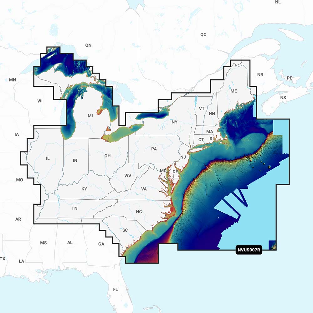
Garmin Navionics Vision+ NVUS007R U.S. East
Garmin Navionics Vision+ NVUS007R U.S. East is backordered and will ship as soon as it is back in stock.
Product Description
Product Description
The Garmin Navionics Vision+™ NVUS007R U.S. East is the top choice for marine enthusiasts, offering unparalleled marine mapping solutions with the most up-to-date Navionics®+ cartography. Whether you're navigating offshore or exploring inland waters, this comprehensive system provides detailed, integrated mapping of coastal areas, lakes, rivers, and more, ensuring a superior boating experience.
Exceptional Mapping and Bathymetry
The Vision+™ NVUS007R delivers SonarChart™ 1’ (0.5 meters) HD bathymetry maps for precise depth information. Enhanced with advanced features like dock-to-dock route guidance technology, live mapping, and Plotter Sync, this device ensures you have the latest chart data at your fingertips. The Navionics® Chart Installer software guarantees fresh chart data every time you set sail.
Advanced Navigation Features
- Integrated Garmin and Navionics® Content: Experience exceptional coverage, clarity, and detail with a familiar interface.
- Daily Chart Updates: Easily access updates via the Navionics® Chart Installer or wirelessly through the Plotter Sync feature using the Navionics Boating app.
- Route Guidance Technology: Receive suggested paths through channels, inlets, and marina entrances based on your boat settings and frequently traveled routes. (Note: Route guidance is for planning purposes only and does not replace safe navigation operations.)
- Community Edits: Download and view local information contributed by other Navionics Boating app users on your compatible chartplotter.
- SonarChart™ HD Bathymetry: Detailed bottom structure depiction with contours up to 1’ (0.5 meters).
- Fishing Range: Highlight a user-defined target depth range for optimal fishing spots.
- Shallow Water Shading: Easily navigate shallow waters by highlighting depths up to a user-defined level.
- SonarChart™ Live Mapping: Create personal 1’ HD bathymetry maps in real-time as you navigate.
- Worldwide Coverage: Enjoy comprehensive mapping coverage wherever you boat.
- Flexible Updates: Available on microSD™ cards with annual renewable subscriptions (first year of updates included).
Key Specifications
| Feature | Description |
|---|---|
| Bathymetry Maps | SonarChart™ 1’ (0.5 meters) HD |
| Route Guidance | Dock-to-dock route suggestions |
| Live Mapping | Real-time 1’ HD bathymetry creation |
| Updates | Daily chart updates via Chart Installer or Plotter Sync |
| Compatibility | Multiple Garmin chartplotters (see below) |
Compatible Devices
- Echomap UHD (7/9)
- Echomap Ultra (10/12)
- GPSmap 10X2/12X2
- GPSmap 12X2 Touch
- GPSmap 7X2, 9X2, 12X2 Plus
- GPSmap 7X3/9X3/12X3
- GPSmap 8400/8600
- GPSmap 8700 Black Box
Delivery and Shipping
Delivery and Shipping
Orders of physical products placed by 3 PM EST M-F typically ships the same day, if all requested items are in stock. Weekend orders will typically ship on Monday.
Shipping takes 2-7 days.
We currently ship to the Contiguous 48 States.
Life of Sailing merch is custom made for the customer after an order is placed. Total turnaround is typically 7-14 days from order to doorstep.
Payment & Security
Payment methods
Your payment information is processed securely. We do not store credit card details.


