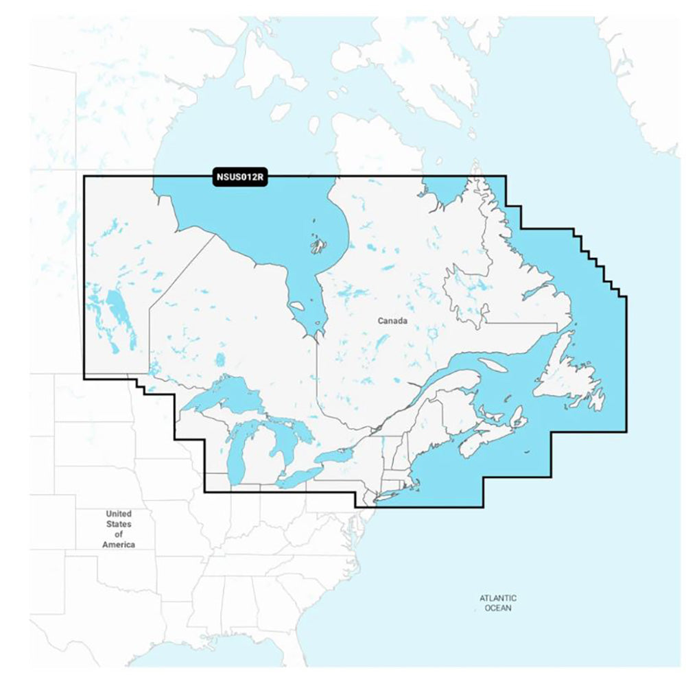
Garmin Navionics+ NSUS012R Canada, East Great Lakes
Garmin Navionics+ NSUS012R Canada, East Great Lakes is backordered and will ship as soon as it is back in stock.
Product Description
Product Description
Enhance your boating experience with the Navionics+™ NSUS012R Canada, East & Great Lakes chartplotter map. Designed specifically for Garmin chartplotters, this comprehensive marine mapping solution offers detailed coastal and inland navigation, vibrant colors, and an intuitive interface, making it easier than ever to plot your courses with precision and confidence.
Key Features
- Flexible Storage: Compatible with microSD™ and SD™ formats for easy data management.
- Comprehensive Coverage: Navigate confidently with the best offshore and inland lake coverage available.
- Customizable Views: Tailor your map display using various chart layers and overlay combinations to suit your navigation needs.
- ActiveCaptain® Integration: Enjoy a one-year subscription that provides daily updates through the ActiveCaptain® smart-device app.
- Auto Guidance+™ Technology: Utilize intelligent dock-to-dock routing suggestions for safer and more efficient navigation.2
- Depth Range Shading: Select up to 10 color-shaded target depth ranges to identify prime fishing spots at a glance.
- Subscription Benefits: Save money by renewing your subscription to continue accessing daily updates and new content downloads.
Coverage Area
The Navionics+™ NSUS012R offers expansive coverage of Eastern Canada, excluding Yukon (YT) and Northwest Territories (NU). Key areas include:
- The Great Lakes
- The St. Lawrence River
- The Maritime Provinces
- The Grand Banks
All-In-One Mapping Solution for Garmin Chartplotters
Access detailed and rich mapping of coastal features, lakes, rivers, and more with the Navionics+™ NSUS012R. The integrated Garmin and Navionics® content ensures comprehensive coverage for boaters navigating waters worldwide.
Daily Chart Updates
Stay up-to-date with the latest marine information. The one-year subscription includes access to daily chart updates via the ActiveCaptain® app, ensuring your maps are always current with up to 5,000 updates made every day.
Auto Guidance+™ Technology
Leveraging the advanced routing capabilities of Garmin and Navionics®, the built-in Auto Guidance+™ technology provides suggested dock-to-dock paths through channels, inlets, marina entrances, and more, enhancing your navigation planning.
Depth Range Shading
Easily identify the best fishing spots with high-resolution depth range shading. Users can choose up to 10 color-shaded options to view designated target depths at a glance, optimizing your fishing strategy.
Up to 1’ Contours
Gain a clearer depiction of underwater terrain with up to 1-foot contours. This feature enhances fishing charts and provides detailed information in swamps, canals, harbors, marinas, and other complex waterways.
Shallow Water Shading
Avoid shallow waters with ease using user-defined depth shading. This feature highlights shallow areas, helping you navigate safely and prevent grounding.
ActiveCaptain® Community
Tap into community-sourced content for valuable Points of Interest (POIs) such as marinas, anchorages, hazards, and local businesses. Benefit from recommendations and insights shared by experienced boaters familiar with the local environment.
1 Auto Guidance+™ is intended for planning purposes only and does not replace safe navigation practices.
Delivery and Shipping
Delivery and Shipping
Orders of physical products placed by 3 PM EST M-F typically ships the same day, if all requested items are in stock. Weekend orders will typically ship on Monday.
Shipping takes 2-7 days.
We currently ship to the Contiguous 48 States.
Life of Sailing merch is custom made for the customer after an order is placed. Total turnaround is typically 7-14 days from order to doorstep.
Payment & Security
Payment methods
Your payment information is processed securely. We do not store credit card details.


