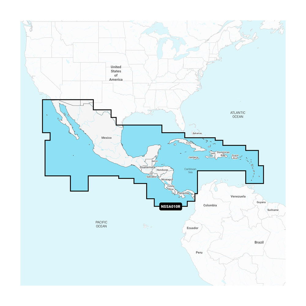
Garmin Navionics+ NSSA010R Central America Caribbean
Garmin Navionics+ NSSA010R Central America Caribbean is backordered and will ship as soon as it is back in stock.
Product Description
Product Description
Experience unparalleled marine navigation with the Navionics+™ NSSA010R Central America & Caribbean map, designed specifically for boating enthusiasts. This comprehensive cartography solution offers vibrant, easy-to-read maps, a streamlined interface, and extensive coverage, ensuring you have the most reliable tools for your maritime adventures.
Comprehensive Coverage
The Navionics+™ NSSA010R provides detailed navigation charts covering the west coast of Mexico from Tijuana to Panama, including the entire Panama Canal. On the east coast, navigate confidently from Panama to Brownsville, TX. Additionally, enjoy expansive Caribbean coverage, featuring the Far Bahamas, Turks & Caicos, Cuba, Jamaica, the Cayman Islands, Haiti, the Dominican Republic, Puerto Rico, and the Lesser Antilles extending to Grenada.
Advanced Mapping Features
Equipped with a microSD™/SD™ format, this map solution integrates seamlessly with Garmin chartplotters, offering some of the best offshore and inland lake coverage available. Customize your view effortlessly with a variety of chart layers and overlay combinations, allowing you to tailor your navigation experience to your specific needs.
All-In-One Map Solution for Garmin Chartplotters
Access detail-rich mapping of coastal features, lakes, rivers, and more. The integration of Garmin and Navionics® content ensures comprehensive coverage for boaters worldwide, making it the perfect all-in-one map solution for your chartplotter.
Real-Time Updates with ActiveCaptain®
Your one-year subscription grants access to daily chart updates through the ActiveCaptain® smart-device app, ensuring your maps are always up-to-date with the latest navigational information. Benefit from up to 5,000 daily enhancements to your charts, keeping you informed and secure on every voyage.
Auto Guidance+™ Technology
Navigate with confidence using the integrated Auto Guidance+™ technology. This feature combines Garmin and Navionics® routing capabilities to provide suggested dock-to-dock paths through channels, inlets, marina entrances, and more, streamlining your journey from start to finish.1
Enhanced Depth and Contour Visualization
Depth Range Shading
Identify the best fishing spots with ease by selecting up to 10 color-shaded target depth ranges. This high-resolution shading allows you to assess depth information at a glance.
1’ Contours
Navigate and fish with precision using up to 1-foot contours, offering a clear depiction of bottom structures for enhanced navigation and fishing charts. Gain improved visibility in swamps, canals, harbors, marinas, and more.
Shallow Water Shading
Avoid shallow hazards with user-defined depth shading, providing a clear visual representation of shallow waters to ensure safe passage.
Raster Cartography
For a traditional, paper chart-like view, the Navionics+™ NSSA010R includes NOAA raster cartography for select U.S. waters. Easily download this feature for free through the ActiveCaptain® app, compatible with mobile devices.2
Community-Sourced Insights
Leverage the power of the ActiveCaptain® Community, which provides a wealth of Points of Interest (POIs) such as marinas, anchorages, hazards, businesses, and more. Gain valuable recommendations and insights from fellow boaters who are familiar with the local environment.
Subscription Benefits
Maximize the value of your investment by renewing your one-year subscription. Continue accessing daily updates, downloading new content, and unlocking premium features that enhance your chartplotter's capabilities.3
1 Auto Guidance+™ is intended for planning purposes only and does not replace safe navigation practices.
2 Raster cartography cannot be viewed on echoMAP™ CHIRP and ECHOMAP™ Plus combos but is accessible on mobile devices via the ActiveCaptain® app.
3 A subscription is required; the one-year subscription included with the purchase of the Navionics Vision+ mapping solution provides access to daily chart updates and allows for downloading additional content or premium features included with the cartography product.
Delivery and Shipping
Delivery and Shipping
Orders of physical products placed by 3 PM EST M-F typically ships the same day, if all requested items are in stock. Weekend orders will typically ship on Monday.
Shipping takes 2-7 days.
We currently ship to the Contiguous 48 States.
Life of Sailing merch is custom made for the customer after an order is placed. Total turnaround is typically 7-14 days from order to doorstep.
Payment & Security
Payment methods
Your payment information is processed securely. We do not store credit card details.


