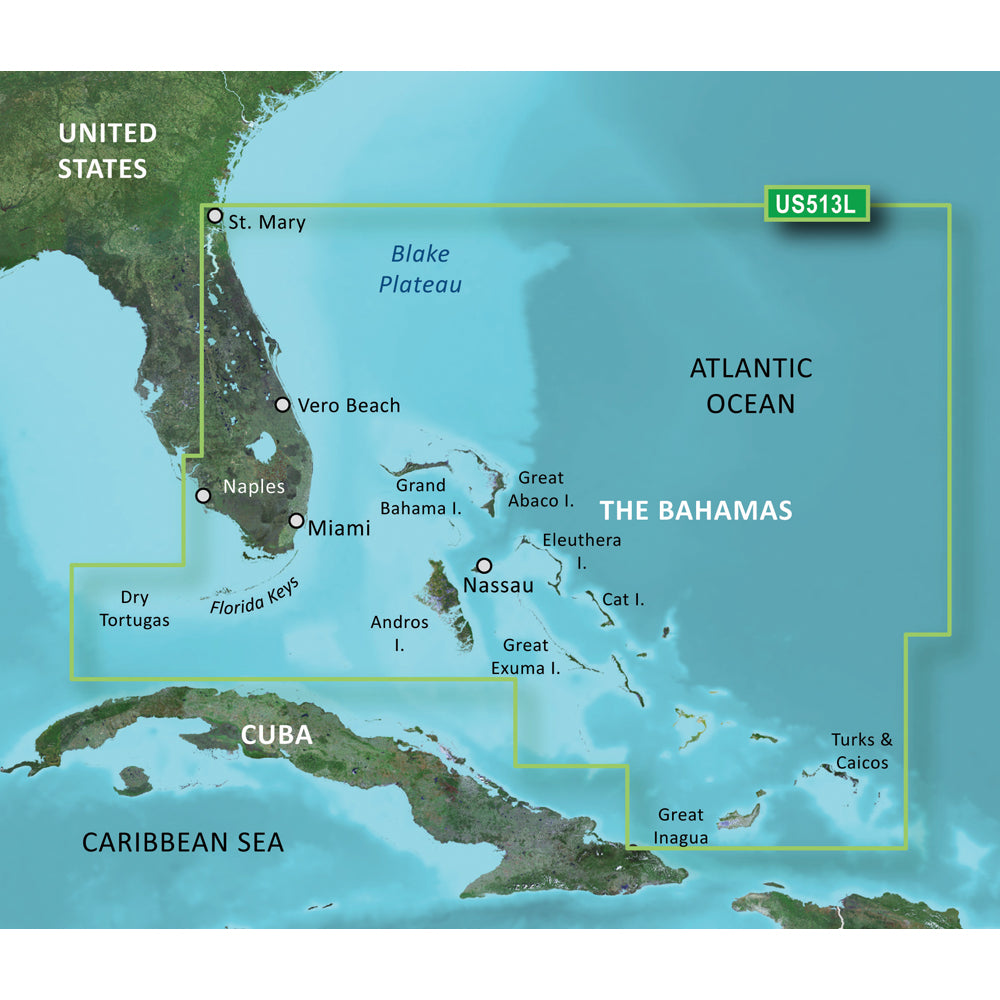
Garmin BlueChart g3 Vision HD - VUS513L - Jacksonville - Bahamas - microSD/SD
Garmin BlueChart g3 Vision HD - VUS513L - Jacksonville - Bahamas - microSD/SD is backordered and will ship as soon as it is back in stock.
Product Description
Product Description
Enhance your boating experience with the BlueChart® g3 Vision® HD - VUS513L, designed specifically for Jacksonville, the Bahamas, and compatible with microSD™/SD™ cards. This advanced coastal navigation chart offers comprehensive coverage and state-of-the-art features to ensure safe and efficient navigation through Florida’s diverse waterways and beyond.
Comprehensive Coverage Area
The BlueChart® g3 Vision® HD - VUS513L provides extensive coverage of the Florida Peninsula, extending from St. Marys, GA, through the bustling Port of Miami, and reaching Fort Myers on the Gulf Coast. Key inland waterways covered include:
- St. Johns River
- Crescent Lake
- Lake George
- Lake Monroe
- Lake Jesup
- Lake Harney
- Lake Okeechobee
- St. Lucie Canal
- Caloosahatchee River
Additionally, this chart extends to the scenic Florida Keys, the pristine waters of the Bahamas, and the Turks and Caicos Islands. Offshore bathymetric coverage includes significant underwater features from Blake Canyon through Santaren Channel to Torgtugas Terrace, encompassing the Blake Escarpment and the Great Bahama Bank.
Top-Tier Navigation Features
Premier Coastal Navigation Charts
Experience industry-leading coverage, clarity, and detail with BlueChart g3 Vision’s updated coastal charts. These charts integrate data from renowned providers Garmin and Navionics®, ensuring reliable and precise navigation information.
Auto Guidance Technology
The innovative Auto Guidance feature¹ allows you to set your desired depth and overhead clearance. It then calculates optimal routes and suggests the best path to follow, simplifying route planning and enhancing safety on the water.
High-Resolution Relief Shading
Our high-resolution relief shading combines vibrant colors and shadows to provide a clear and interpretable view of underwater structures, surpassing the clarity offered by traditional contour lines alone.
Depth Range Shading
With up to 10 customizable depth ranges, Depth Range Shading enables you to quickly identify your target depth, making navigation and depth management effortless.
Detailed Contour Lines
Featuring contour lines up to 1’ increments, BlueChart g3 Vision offers an accurate depiction of the seabed, enhancing fishing charts and navigation through swamps, canals, and marinas.
NOAA Raster Cartography
For those who prefer the familiar look of paper charts, NOAA Raster Cartography2 is available as a free downloadable feature via the ActiveCaptain® app. Please note that raster cartography cannot be viewed on echoMAP CHIRP and ECHOMAP Plus combos but is accessible on mobile devices through the ActiveCaptain mobile app.
Shallow Water Shading
This feature allows you to highlight and avoid shallow water areas by designating specific depth thresholds, ensuring safe passage through challenging waters.
High-Resolution Satellite Imagery
Stay informed with detailed satellite images of ports, marinas, bridges, and other navigational landmarks, providing superior situational awareness and aiding in precise navigation.
Unique 3-D Views
Explore waters like never before with MarinerEye and FishEye views, offering additional perspectives both above and below the waterline for a more immersive navigation experience.
Additional Information
For comprehensive guidance on using your BlueChart® g3 Vision® HD - VUS513L, refer to the Owner's Manual (PDF).
Important Notices
 WARNING: This product can expose you to chemicals which are known to the State of California to cause cancer, birth defects, or other reproductive harm. For more information, visit P65Warnings.ca.gov.
Return Policy: This product may not be returned to the original point of purchase. Please contact the manufacturer directly with any issues or concerns.
¹Auto Guidance is intended for planning purposes only and does not replace safe navigation practices.
²Raster cartography is unavailable on certain device combos but is accessible via the ActiveCaptain mobile app.
Delivery and Shipping
Delivery and Shipping
Orders of physical products placed by 3 PM EST M-F typically ships the same day, if all requested items are in stock. Weekend orders will typically ship on Monday.
Shipping takes 2-7 days.
We currently ship to the Contiguous 48 States.
Life of Sailing merch is custom made for the customer after an order is placed. Total turnaround is typically 7-14 days from order to doorstep.
Payment & Security
Payment methods
Your payment information is processed securely. We do not store credit card details.


